The grey island · Central group
Pico
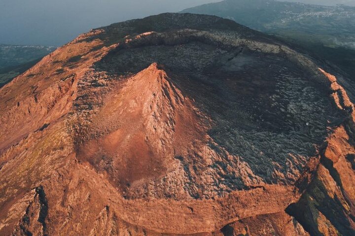
Pico has Portugal’s highest mountain and vines grown inside lava walls. The island covers 445 km². You can fly to Pico Airport or arrive by ferry.
Pico facts
- Island group
- Central, across the channel from Faial
- Airport
- Pico (PIX)
- Area
- 445 km²
- Highest point
- Mount Pico, 2,351 m
- Population
- about 13,883
Pico weather now
Observed 6 October 2026 at 19:00, Azores timeCabecinho the uplands, 562 m
17.1° · 90% hum.
Cabeço do Teicho the uplands, 847 m
16.1° · 87% hum.
Pico the coast
21.9° · 69% hum.
Weather differs between the coast and the uplands. 5.8 °C between the warmest and the coolest station right now. Three IPMA stations on Pico.
Places on Pico
Mount Pico
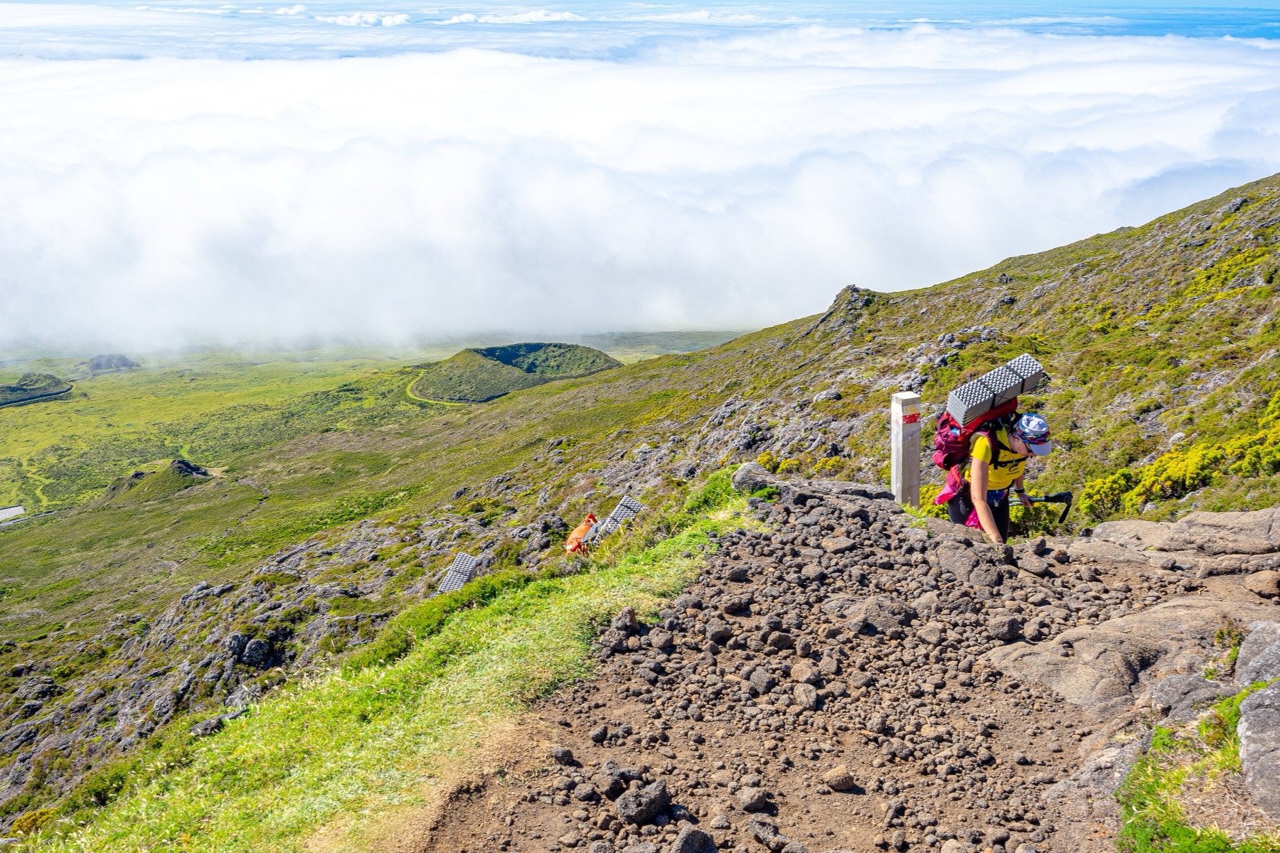
Mount Pico is Portugal’s highest mountain at 2,351 m. The guided climb starts at Casa da Montanha.
The vineyards of Criação Velha
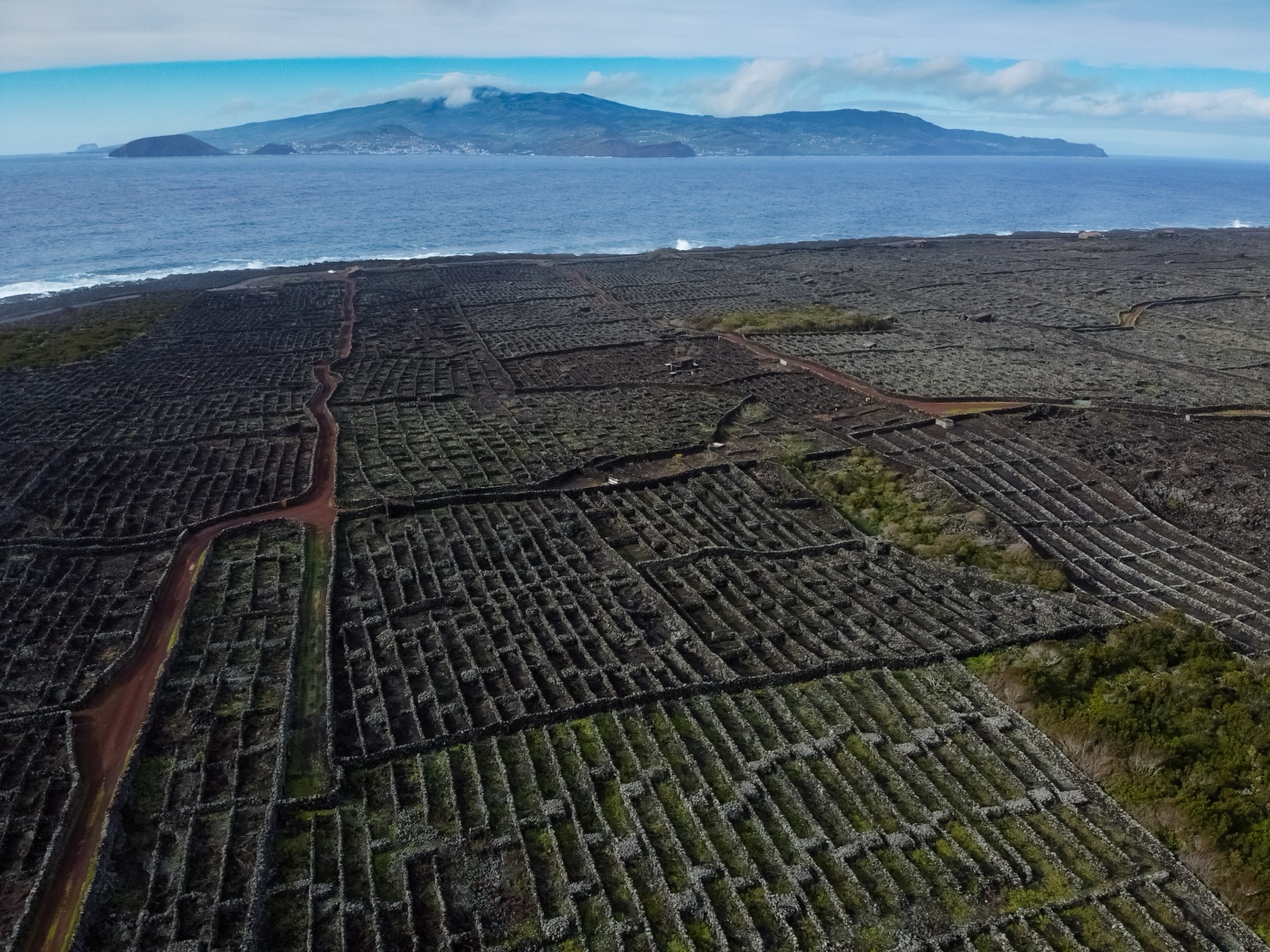
Criação Velha’s vines grow inside black lava walls near Madalena. The vineyards form a UNESCO World Heritage landscape.
Gruta das Torres
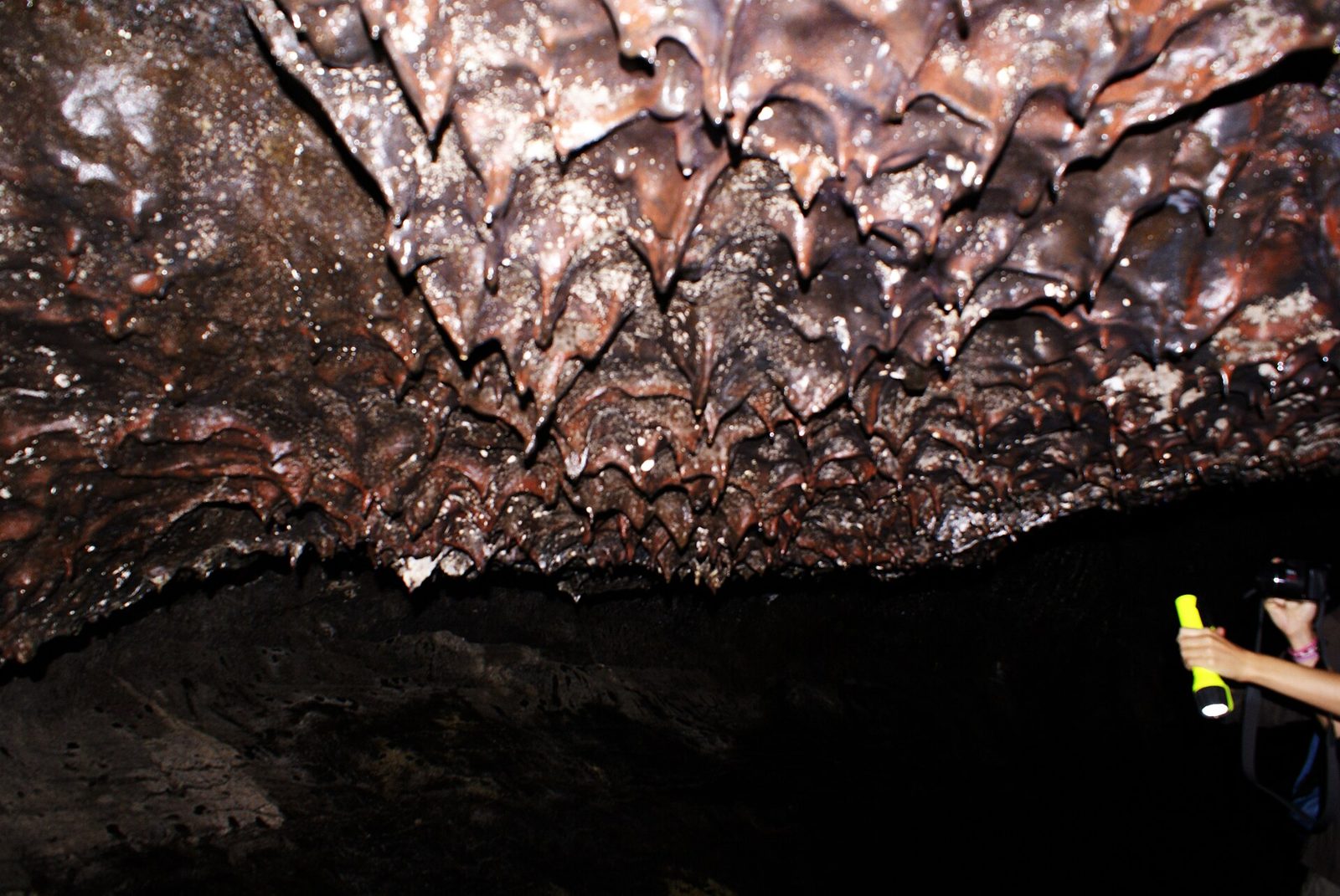
Gruta das Torres is Portugal’s longest lava tube. You visit by torchlight with a guide.
Tours from Pico
Walks on Pico
14 of 14 marked routes open right now, read from the regional trail network on 6 October 2026.
- open
Caminho das Lagoas PR19PIC
Linear, easy, 7 h · 22 km
- open
Caminhos de Santa Luzia PR01PIC
Linear, medium, 3 h · 9.4 km
- open
Lagoa do Capitão PR13PIC
Linear, medium, 3 h · 9.3 km
- open
Calheta do Nesquim PRC11PIC
Circular, medium, 3 h · 9.1 km
- open
Caminho dos Burros: Vertente Norte PR02PIC
Linear, medium, 3 h 30 min · 8.9 km
How to get to Pico
By air
Pico Airport (PIX) has Azores Airlines flights from Lisbon. SATA Air Açores flies from Ponta Delgada and Terceira.
Between the islands
The ferry ports are Madalena and Cais do Pico. Atlânticoline serves both ports.
Plan your visit
Getting around
I’d pair Madalena with the nearby Criação Velha vineyards. For the linear 22 km Caminho das Lagoas walk, arrange a return journey.
How long to stay
Let your walks set the length of your stay. Caminho das Lagoas alone takes 7 hours. I’d leave separate time for Mount Pico and Gruta das Torres.
Best time
I’d choose dates around the guided Mount Pico climb. Check the live IPMA readings when planning your time outside.
Roman Antonov, editor
I live in Portugal and I love these islands. The weather here is read live from IPMA stations; prices and tour details come from Viator, dated on each page.