São Jorge
Serra do Topo trail via Caldeira de Santo Cristo PR01SJO
PR01SJO runs from Serra do Topo to Fajã dos Cubres on São Jorge. This linear walk descends to Caldeira de Santo Cristo. It then follows the coast to Fajã dos Cubres.
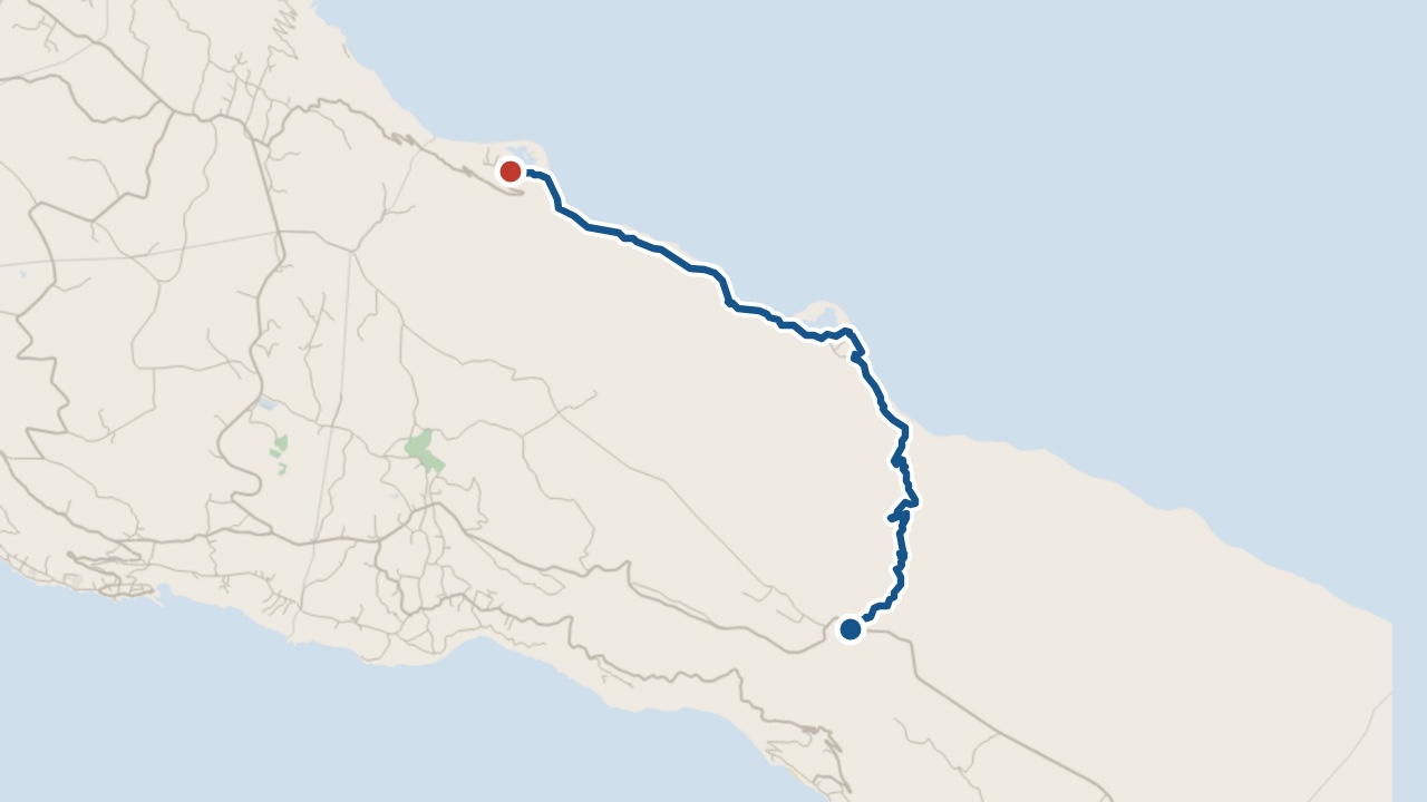
The walk
The 9.3 km route starts on a dirt road. You descend through Caldeira de Cima, passing standpipes along the way. After Caldeira de Santo Cristo, follow the coast northwest. Finish at Fajã dos Cubres.
Take care on slippery ground by the Cascata Pequena detour. The trail descends towards Caldeira de Cima before reaching the coast.
What you'll see on the walk
Cascata Pequena
The waterfall lies beyond Tia Júlia bridge.
Senhor Santo Cristo Sanctuary
You pass this sanctuary in the fajã.
Caldeira de Santo Cristo Lake
The lake supports resident and migrating birds.
Fajã do Belo
The coast path passes through this fajã.
Fajã dos Cubres
The trail finishes near the church of Nossa Senhora de Lourdes.
Getting to the start
Start beside the Serra do Topo wind farm. Arrange a pick-up at Fajã dos Cubres to return to the start.
Pico do Areeiro · weather now
14.1°C
Observed , Azores time · IPMA
Serra do Topo to Fajã dos Cubres via Caldeira de Santo Cristo map and GPX
The GPX track, the official trail page and directions to the start in Maps.
Closures and alerts
Trail status updates automatically twice a day. Check the latest Visit Azores alerts before you walk. Read the official route page for any section restrictions. See the alerts page →
The fajã it leads to
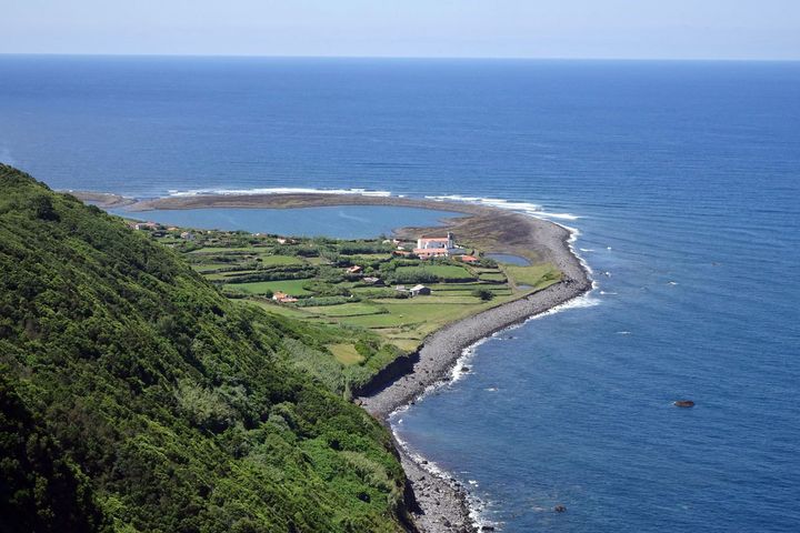
Fajã da Caldeira de Santo Cristo
A fajã on the north coast of São Jorge with a coastal lagoon, reached on foot from Serra do Topo or from Fajã dos Cubres.
Roman Antonov, editor
I live in Portugal and I love these islands. Trail status updates twice a day from Visit Azores alerts. The date shows our last check. Use “Check the status now” before you walk.