Faial
Faial Caldeira trail PRC04FAI
Caldeira (PRC04FAI) is a circular walk around Faial’s crater rim. It starts at the Caldeira viewpoint and climbs towards Cabeço Gordo before returning.
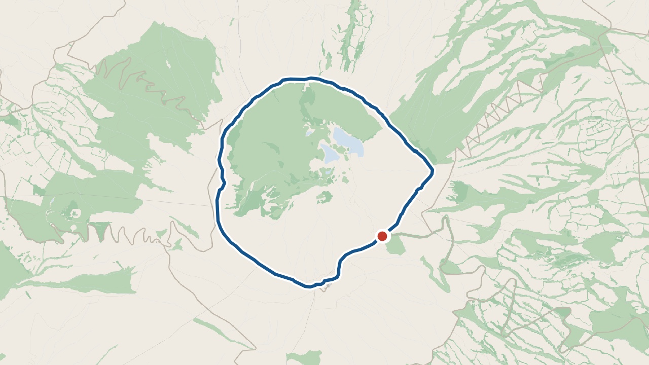
The walk
The 6.8 km circuit begins at the Caldeira viewpoint. A short tunnel gives you a view into the crater. Return to the road and climb the steps towards the Chapel of São João. The rim path leads towards Cabeço Gordo.
Take care on the uneven descent to the viewpoint. Cabeço Gordo is the highest point at 1,043 m. Choose a day with good weather and clear visibility.
What you'll see on the walk
Caldeira viewpoint
The tunnel reveals laurel forest plants inside the crater.
Chapel of São João
A dirt track leads towards the chapel.
Endemic plants
Azores Juniper (Juniperus brevifolia) grows here.
Faial’s north and west coasts
Views reach Faial’s north and west coasts.
Cabeço Gordo
The path climbs here before heading downhill.
Getting to the start
Start at the Caldeira viewpoint. There is a car park here.
Alto do Cabouco · weather now
14.8°C
Observed , Azores time · IPMA
Caldeira map and GPX
The GPX track, the official trail page and directions to the start in Maps.
Closures and alerts
Trail status updates automatically twice a day. Check the latest Visit Azores alerts before you walk. Read the official route page for any section restrictions. See the alerts page →
The crater it circles
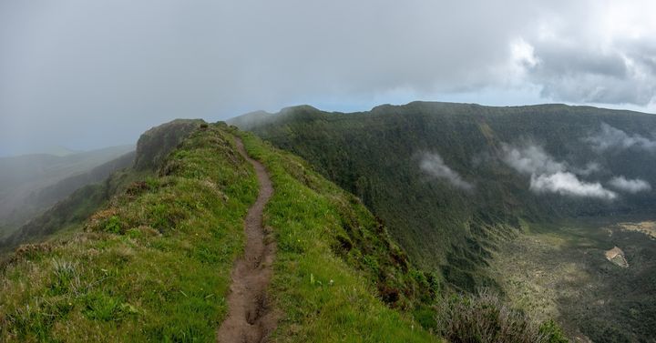
The Caldeira
A crater about 2 km across in the centre of Faial. It is a nature reserve. The rim path reaches Cabeço Gordo.
Roman Antonov, editor
I live in Portugal and I love these islands. Trail status updates twice a day from Visit Azores alerts. The date shows our last check. Use “Check the status now” before you walk.